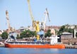
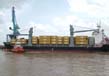
Ports In Gujarat
With the longest coastline measuring 1,600 Kms in the country, Gujarat is located on the Western coast of India and shares its borders with its neighbors Rajasthan, Madhya Pradesh, Maharashtra and the Union Territories of Daman and Diu and Dadra and Nagar Haveli. The State is bordered both on the western as well as the south western sides by the Arabian Sea.
Porbandar Port
About
Situated on the western coast of Saurashtra and facing the Arabian Sea is Porbandar, an all-weather port having direct berthing facilities.
Commodities Handled
Import: Fertilizers, Coal & LPG
Export: Oil cakes, groundnuts, HPS, Salt, cement/Clinker, Chemicals, Raw Cotton, Clay Bauxite, Building Materials, reefer cargo, onions and fruits.
Port Connectivity
- State Highway (SH-95) is about 3 km away from the port
- Broad gauge rail link is connected with the jetty
- National Highway (NH-8E) is about 2 km away from the port
- Nearest urban center Porbandar is about 3 km away
- Nearest airport Porbandar is about 8 km away
Present Facilities
Harbor Structures
- Wharf for steamers: length 385 m (235 m GMB wharf and 150 m private jetty of SCL) with permissible draught up to 9.8 m.
- Landing and berthing: Total 2,128 meters in length for lighters. Fishing activities are being performed from these berths.
- Finger jetty along the breakwater of length 100 m for lighter age.
- It has a total of 175 meters of Coast Guard jetty in length.
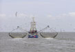
- With total of five fishing jetties Porbandar is an accomplished Terminal for Fishery.
Facilities
- Tugs - 2 nos.
- Launches - 2 nos.
- Godown Facilities - 2, 41,173 Sq. m
Contact
The Port Officer, Gujarat Maritime Board, Wagheshwari Plot, Nr. Jadeja Hospital, Porbandar - 360575
Tel: 0286-2242 408/438 • Fax: 0286-2244013
E-Mail: [email protected] , [email protected] (Additional Port Officer), [email protected] (SE)
Jafrabad Port
About
Placed within the Gulf of Cambay on the south western coastline of Saurashtra, within the Jafrabad Creek on the western coastline of India is Jafrabad which is an all-weather direct berthing Port for small seafaring vessels.
Commodity Handled
Import : Coal, Coke
Export : Clinker, Salt
Connectivity of Port
- The port is linked to the State Highway No-34.
- Rajula which has a broad guage railway line is 22 Km away from the port.
- The distance between the port and the National Highway No.-8E is approximately 20 kms .
- Adjoining urban center is Rajula which is approximately 21 Km away from the port.
- The Diu Airport is just 75Km away from the port.
Current Facilities
Structures of Harbor
- RCC quayside for loading Clinkers (near Clinker Jetty): 211 m long, allowing a 4m draft. At the harbor, loading process is performed mechanically, with the help conveyor belts.
- RCC quayside for mounting salt and assorted cargo: 45m long
- Gradient for cargo vessel: 30m long
- Fish-landing dock: 450m long
Port Facilities and Infrastructure: Landing Facilities
- New Clinker Quayside/Jetty designed for small size shoreline steamers, with an effective measurement of 4m and 211m draft. Small shoreline steamers land at this jetty as Clinker, Coke and Coal are exported from here by the Narmada Cement Co. Ltd., Jafrabad, and a sister conern of M/s Ultra Tech Cement Co. Ltd.
- RCC quayside for regulating traffic of sailing vessels that are 45m long, with a 1m draft.
- A fish-loading quayside is available for fishing jobs, 400m long and with a appropriate draught.
- For small boats and commuters there are drafts and 3 onset slants with length of 0.30m by30m.
Warehousing and Storage Facilities
There are available as many as seven godowns with 1,310 sq m built area, having a storage competency of 2,500 MT. In addition to this adequate open space is offered.
Private Bunkering and Ship stores are Available
Contact
Gujarat Maritime Board, Jafrabad - 365 540
Tel: (O) 02794-245165
Telefax: 02794-245152
E-Mail: [email protected]
Okha Port
About
Okha is situated on the north-west coast of the Saurashtra Peninsula, at the mouth of the Gulf of Kutch on the west coast of India and is an all weather port with direct berthing facilities.
Commodity Handled
Import: Mineral Oil, coal, wheat, sulphur, coke, fertilizer
Export: Raw bauxite, calcium Bauxite, chemicals, salt, clinker.
Port Connectivity
- Port is well connected with the State Highway (SH-6A)
- Broad gauge rail link is directly connected with the port
- National Highway (NH-8E) is about 28 km from the port
- Nearest urban center Jamnagar is about 105 km away
- Nearest airport, Jamnagar is about 175 km away
Prospective Development
The section of road measuring 22.7 Kms. from Dwarka to Okha is projected to be completed by 2012 with a total computed cost of INR 56.7 crore.
Present Facilities
Harbor Structures
1) Sayaji Pier:
- Total length 180 m
- Width 20 m
- Approach 114 m
- Berthing capacity 2- vessels at a time
- Draft 8 m
2) DCB Pier:
- Total length 145 m
- Width 14 m
- Approach 216 m
- Berthing capacity 2- vessels
- Draft 4 m
3) New Lighter Wharf:
- Length 100m
Facilities
- Tug - 2 no. 1,600 BHP.
- Barges - Private barges are available (no port barges)
- Launch - 1 no. passenger launch 470 BHP
- Cranes - 1 nos. of 12.5 tonnes
- Warehousing & Storage facilities - 16 Godowns & Two open sheds
- Stacking Area is 50,000 sqm
Contact
The Port Officer, Gujarat Maritime Board Okha Port, Okha-361350
Tel: 02892-262001/02/262039
Fax: 02892-262002
E-Mail : [email protected]
View More Ports of Gujarat
Related Image
Also Browse Following Under This Section
Related Topics
Roads In Gujarat
Gujarat is a haven of a mammoth transportation network encompassing national highways, state highways, district highways....
Cities and Destinations
Gujarat is the 7th largest state and is located in the western part of India. It is one of the most popular tourist....
Gujarat - "The Land of the Legends"
Discover the knowledge of brilliance in...