Roads In Jammu And Kashmir
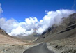
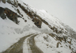
The Indian state of Jammu and Kashmir is well known for its environmental beauty, and an endless array of snow capped mountains that run along its road.
Having China and Pakistan in its land is enough to show how vast this state is, it is even recorded as the 6th largest state in India. This fact is enough to make any visit to this ‘Paradise on Earth’ a memorable and refreshing one. Especially during the summer breeze that can be enjoyed by the locals and even tourist alike, the visit will be worth remembering. This state offers lots of activities that can be enjoyed right from the adrenaline junkie to a more laidback traveler.
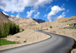
Getting there will not be a hassle as there are many roads from all over places in north India. It is easy to reach here since it is located on the National Highway number 1-A. It is even opened every day throughout the year including during the heavy snow and monsoon season. Since the state is located closed to lots of the international borders with lots of tension arise, the government is giving them lots of priority. Among the countries connected to Jammu and Kashmir is Amritsar with only 243 Kms in length, Delhi 586 Kms, Chandigarh 436 Kms, and the closest is Katra which is only 43 Kms. The closeness between these countries reflects why the government is giving a great deal of attention to have good quality road here.
National Highways
All the highway under the National Highways Network of Jammu and Kashmir is administered and maintained by India’s government link agencies.
One of the agencies involved with this project is the National Highways Authority of India (NHAI). It is in charge of the construction, enhancement and repairing work for the highway network. This project under the National Highway Development Project (NHDP) marked as the biggest effort by the government to enhance the network of highways in Jammu and Kashmir. However, NHAI usually employs other public-private company for all the works regarding the highway including toll collection.
National Highway 1A (India)
The highway that is simply referred to as NH 1A is the main National Highway around North India linking other parts of India to Kashmir Valley and Jammu. The main link on this highway is situated in Uri in Jammu and Kashmir for the northern terminal and Jalandhar for the southern terminal. Although this highway is highly advanced in terms of quality, it runs along a very unpredictable area. Thus, to avoid any disasters like avalanches and landslide that is common during winter time becomes challenging. With the total journey of 663 Km, NH 1A also runs through the popular Jawahar Tunnel and Pir Panjal Range Falls that link Jammu with Kashmir Valley.
There is also another option for this highway which is still under revision. The road is believed to make travelling time and distance between two cities shorter by up to two-thirds and 82 Km respectively. Also, it can be used all the year round.
Another road connect Srinagar to Jalandhar which is a unit of the North-South Corridor under the NH 1A runs a total length of 554 Km.
National Highway 1B (India)
For the internal usage in Jammu and Kashmir, there is the National Highway 1B or simply referred to NH1B is available. It is connecting the district of Batote to Khanbal with an approximate length of 274 Km.
National Highway 1C (India)
Another road that connects places inside the state of Jammu and Kashmir is the National Highway 1C also referred as NH 1C. It is a short highway with a total length of 8 Km linking Domel and Katra. It was later renamed as National Highway 144 or NH 144 which is part of NH-1.
National Highway 1D (India)
Another Highway, also known as Srinagar-Leh Highway is the National Highway 1. It is the interstate highway that links Jammu and Kashmir in North with Srinagar all the way to Leh in Ladakh. This highway is supervised by Project Vijayak from the Border Roads Organisation. This is the alternatives path besides the Leh-Manali Highway that link Ladakh with the other part of India, and it was declared as National Highway in 2006.
There is also an old trade path in Central Asia connecting Srinagar to Leh and Yarkand. It is recognized as Treaty Road since Maharaja Ranbir Singh and Thomas Douglas Forsyth had signed a treaty in 1870.
Kashmir Highway
The common path use to travel along Jammu and Kashmir which is a prior princely state was the Kashmir Highway. It was constructed during the ruling of Maharaja of Kashmir Gulab Singh in 1882 and became a prominent highway connecting Jammu and Kashmir with Punjab. This road did not last long as it was damaged after India and Pakistan was declared as an independent country by the Britain.
This highway can be divided into two sections that are control by the Indian government on the east side and Pakistani government on the western side. The eastern side runs from Srinagar to Leh while the Western side runs from Rawalpindi to Srinagar through Murree, and the Kohala Bridge that is the bridge used to connect Pakistan with Azad Kashmir.
Since the section of highway is under control of different government, Pakistanis cannot travel pass the Kohala Bridge while Indians are not allowed to pass starting from Srinagar onwards to Pakistan.
Leh–Manali Highway
Linking between the district of Leh in Ladakh, Jammu and Kashmir state and Manali in the state of Himachal Pradesh is the Leh-Manali Highway that is located in North India. It can only be access during the summer which is on May or June each year roughly about four and a half months before the heavy snow closed the road. The snow is then removed by Border Roads Organisation so it can be used again starting from mid-October before heavy snow once again blocks the road. This road is also a section of NH 21 that runs from Manali Valley to Lahaul, Spiti Valley, and Zanskar Valley in Ladakh.
The entire highway was created and supervised by the Border Roads Organisation to make sure it can sustain the heaviest army transportation available.
The highway runs an outstanding length of 490 Km where 230 Km of it starts from Manali to Sarchu while another 260 Km starts from Sarchu to Leh.
The Lahaul regions stop at Himachal Pradesh state border for Sarchu section while, for Zanskar region, it begins at Ladakh region of Jammu and Kashmir state.
The view from the highway is very beautiful as it visitor will pass through few of the world highest mountain passes such as the Rohtang La which sit on the altitude of 3, 978 m in Pir Panjal range. Another passes that it will pass located in Zanskar range is the Baralacha La with height of 4, 892 m, Lachulung La with height of 5, 059 m, and Taglang La with height of 5, 328 m. Although some pass will receive more snowfall per year compared to others like the Baralacha La and Rohtang La, all passes cannot be access during winter. From Lachlung La to Tanglang la, the path is more subtle compared to others.
Mughal Road
The Mughal road is located in India, in the state of Jammu and Kashmir is another important path that is commonly used in Kashmir Valley as it links from a town in Poonch district to Baflias with a total length of 84 Km. Crossing over the high pass of Pir Panjal Mountain range at an incredible height of 3, 505 m, is an exhilarating experience. This pass is higher compared to Banihal pass that is only 2, 832 m.
This path is important as it lessen the travelling gap between Poonch and Rajouri with Srinagar that is situated in Kashmir Valley. It had decreased a total travelling length between these two places up to 462 Km from 588 Km. This path is an optional path to Kashmir Valley from other parts of India which is less crowded in comparison to Jammu-Srinagar Highway that passes through the Jawahar Tunnel. Besides the stated states, this path also runs through many important states in India such as Shopia, Dubjan, Heerpora, Zanar, Peer Ki Gali, Aliabad, Chattapani, Chandimarh, Poshana, and Behramgalla.
According to the historian, the path was once used by Moghul emperors in the sixteenth century as a pathway to conquer Kashmir. This road also stored many story in it as the Akbar the Great was reported to have use it for the same purpose as the Moghul emperor in 1586, his son, however, had died on this road closed to Rajouri on the way back from Kashmir.
The construction of a new and better road had been suggested in 1950s with objectives to enhance the Poonch and Rajouri’s district economy. However, the construction only began in 1979 when the Chief Minister during that time, named Sheikh Abdullah oversees this project before it came to stop when the military intervene and destroy the Bafliaz Bridge.
Evaluation of the project was expected around INR 255 Crores and building of road started again in 2005 and as expected to be done by March 2005. However, the suggested path will runs through Hirpora wildlife sanctuary which is the main reason why it receive heavy objection from the people because this will puts the wildlife there in danger, including the Markhoar goat that is on the verge of extinction. Even the opposition party did not agree with this construction as it was irrelevant to them because heavy snow during the winter invariably caused the road to block that was, in reality, supposed to act as an alternative path besides the Jammu-Srinagar Highway. With all the trouble, the Supreme Court had finally given the green light to the project under some condition. Because of that, it was possible to complete construction on 4th December 2008 and started receiving light transportation by summer of 2010. As in August 2012, there is a double lane pathway had been build to accommodate the increase in its user.
An annual rally competition had been organized there starting from 2010 with a total distance of 600 Km through Pir Panjal. The rally was known as Mughal Road Car Rally.
Area Wise Road
For Kashmir
A 300 Kms National Highway 1-A that is suitable to be use in all season had been build for those travelling from Srinagar to Jammu. This road will link Jammu with all districts in Northern India along with New Delhi. Here, there are lots of buses and taxis offering their service to those who are going to the city centre from Jammu Railway station. There are many Tourist Taxi Stands available in Srinagar City offering better services to the tourists. Here, tourists can hire these taxis for a tour around the city or resorts in Kashmir.
For Ladakh
The 434 Kms Srinagar-Leh Highway which can only be access from May or June till October is the main road to Ladakh. After 86, Km, this road will run through the beautiful rural area of Kashmir before climbing uphill towards Zojiala Pass that rests on an altitude of 3, 429 m. The roads also lead to the densely populated Kargil Town which is 205 Km from the start of the highway. Besides this highway, the 473 Km Manali-Leh Road can also be use. It is open from July to September and crosses 5 passes starting from the low Rohtang La at 3, 878 m all the way to the Taglang-la at 5, 360 m. There is a consistent bus service from Srinagar to Leh/Kargil available for everyone that is run by the J&K State Road Transport Corporation. On the other road, the HP Tourism handles coaches for the Manali-Leh route. Other option of travelling to Ladakh is to use taxis that can be obtained in Srinagar and Manali.
For Jammu
Jammu is easily accessible from the rest of the country by using the National Highway 1-A together with other highway network. The following are some of the crucial roads from Jammu:
Significance of Good Roads
Famous for its tourism sector, the government of Jammu and Kashmir had been putting lots of efforts to construct several roads for an easy access by the traveler to this place. However, there are still lots more pathways that need to be created to enable people to get there without draining their energy. The tourism sector reflects how important a good road is for a good business besides acting as a good intercity trading path. Since the natural disaster such as the landslide is a common thing here, the roads built must be able to withstand such a harsh condition to last long. The government also needs to make an initiative to clear the road during the winter season as the heavy snow on the road can cause the vehicle to stop, unable to move.
All the effort is being done by the government continuously and on a large scope. Lots of vehicles started to flow into the state of Jammu and Kashmir because of this improve road condition. Lots of gravel roads have been replace with tar roads while there are also many roads to connect the countryside with the other part of the city. This improvement will enable a better improvement to be made in all parts of the state.
Related Image

Also Browse Following Under This Section
Related Topics
Transportation
Jammu Kashmir tourism is known for its beautiful snow-capped hilly terrain and ancient architecture making it the favoured....
Heaven On Earth
There is saying Heaven is nowhere, but in Kashmir! This can be realized when the flight you are sitting hovers over....
Kailash Mansarovar Yatra
The revered peak; Mount Kailash tower...
Sonamarg Trekking
In Jammu and Kashmir, Trekking is the...