Geography
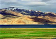
The three major regions of Jammu & Kashmir are the Ladakh, Jammu and the Kashmir valley – all of which are rich in natural landscapes, religions as well as diversity in people. The state is divided into 2 main divisions (Jammu and Kashmir) and 14 smaller districts for administrative purposes. Most of Kashmir valley is covered with thickly forested mountains, lakes & waterways as well as stepped/terraced fields. Jammu region is composed of plains, mountains and the foothills boasting of the famous hilltop shrine, ‘Mata Vaishno Devi’. Coming onto Ladakh, it accounts for nearly two-third of the area and is essentially a cold desert. This region is encompassed by several oasis villages and a couple of ancient Buddhist monasteries.
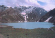
There are several low lying basins in the region; for instance the Poonch Valley, Tawi Valley, Sind Valley, Chenab Valley and the Liddar Valley are some of the notable ones; but the most notable one of all is the basin of Kashmir which spans 100 kilometers wide and 15520.3 sq. Kilometers in area. The average height of the Kashmir valley is around 1700 meters above sea level. The River Jhelum along with its tributaries flows through this Kashmir valley. A few other major rivers flowing through this region include the Indus and the Chenab.
Location
The expanse of J&K is over an area of 222235 sq kilometers. Jammu and Kashmir is encircled by China in the north, by an autonomous region of Tibet in the east, by the Indian states of Himachal Pradesh and Punjab in the south, and by the Pakistani city of Rawalpindi towards the west. Towards the North Western side of J&K, Afghanistan is located.
Jammu & Kashmir was divided into two parts during 1947 and again in the 1965 Indo-China war a large part of the land was severed. The state today consists of three parts namely, the Indian controlled Kashmir (IcK), the Pakistan controlled Kashmir (PcK) and the China controlled Kashmir (CcK). Pakistani administration first divided thePcK into Azad (Free) Kashmir (AK) and Northern Areas (NA); later it donated a large chunk of this land (Shaksam valley of 5180 sq km) to China during its border agreement in 1963; although according to the signed document, the Sino-Pak agreement ceding a part of Kashmir is provisional and that it will be renegotiated with China once the Kashmir dispute is settled.
Thus in order of percentages, 48 percent of the territory is under Indian occupation, 35 per cent is under Pakistan and rest 17 per cent is under the control of China.
Climate
The weather conditions of Jammu and Kashmir vary greatly owing to its irregular topography. In the southern regions around Jammu, the climate is typically monsoonal, though the region is sufficiently far west compared to the average 40 to 50 mm (1.6 to 2 inches) of rain per months during the months of January and March. In the hot seasons, Jammu town is very blistering and can reach temperatures of 104 °F whilst in Aug and July, very heavy and erratic rainfall occurs with monthly extremes of up to 650 millimetres (25.5 inches). By September, rainfall declines, and by beginning of October, conditions are hot and extremely dry, with minimal rainfall and temperatures of around 29 °C (84 °F).
Across from the Pir Panjal range, the South Asian monsoons are no longer a factor and most of the precipitation occurs in the spring from the southwest cloud bands. Due to its closeness to the Arabian Sea, Srinagar receives as much as 25 inches (635 millimetres) of rain from here, with the wettest months being March through May with around 85 millimetres (3.3 inches) per month. Across from the main Himalaya Range, even the southwest cloud bands break up, and the climate of Ladakh and Zanskar regions is extremely dry and cold. Annual precipitation here is only around 100 mm (4 inches) per year and humidity is also very low. This region lies above 3,000 metres (9,750 (ft)) above sea level as such the winters are extremely cold. In Zanskar regions, the average January temperatures are -20 °C (-4 °F) to the extremes reaching up to -40 °C (-40 °F). All the rivers freeze during the time and locals carry out river crossings because of their high levels from glacier, which melt in summers inhibiting their crossing. During summers in Ladakh and Zanskar the days are typically warmer around 20 °C (68 °F) but due to the low humidity and the thin air nights can still be quite cold.
Soils
In Jammu and Kashmir the soils are generally loamy with very little clay content in them. Poor in lime content but with a higher concentration of magnesia; the soils are treated with chemical fertilisers and enriched with green manure legumes before beginning with cultivation on them. There is sufficiently high nitrogen content and organic matter in the soil of Kashmir due to animal excretion, natural vegetation, crops stubble and plant residue. Kashmir showcases different kinds of the earth like the Floating garden soils, Surzamin, Lemb, Nambaal (Peats), Sekil (Sandy), Bahil (Loam), Gurti (clay) as well as Karewa soils.
Forests
Forests are one of the most important resources of Jammu and Kashmir. Spread over 2,236 (sq). Kms of demarcated forest area; it accounts for 20% of the total geographical area of the state on this side of the Line of Control. More than 99% of forest area is confined to the province of Jammu & Kashmir only, with the largest area of 5848 sq. kms in the district of Doda and smallest area of 481 sq. kms. in the district of Budgam. Over 19,236 (sq). Kms is under coniferous softwood (Pine) and another 946 sq. km is under non-coniferous softwood.
In the coniferous category, Fir accounts for 3355 sq. km, whereas Kail for about 1874 sq. km, Chir accounts for around 1773 sq. km and finally Deodar for 1122 sq. km. Since forests require an abundance of moisture in the soil, they are found in the areas where there is sufficient rainfall or along the banks of the rivers where water is easily available. In the State of Jammu and Kashmir forests are mainly found where annual rainfall is about 100 cms. However, scrub forests do occur in regions, where rainfall is less than 100 cm.
The valley of Kashmir has deciduous vegetation. The Walnut, Mulbery, Partal, Chinar, Kail Fir, Pine, Poplar, Deodar, and several others grow all across the valley region. Baramulla & Anantnag has 71% and 60% of their area covered by dense forests respectively.
Bigger forests provide timber and fire-wood in the valley. Grassy meadows in the forest provide fodder for the cattle. Herbs like the menthol, digitalis, balladona, the hyoseyamus are under hot growth. Besides there also are rubus, trilliu, polygola, podophyllum, hops and askuth that grow in abundance in the region. Production houses and mainstream industries across India like herbal drugs, wood carving, furniture, joinery sports goods, paper, silk industry and manufacture of agricultural implements, as well as, construction of railway sleepers depend mainly on these forests.
The thick undergrowth in the forests seen here store the rain water and allow it to flow slowly. This is because the rivers that have their sources in these forests do not run dry in the hot summer seasons, as well as, to help check floods during the rainy season.
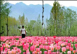
Sonamarg, Pahalgam and Gulmarg, are some of the famous places. Apart from these there are Kokarnag, Verinag and Achhabbal that are some of the famous health resorts located in the thick forests of the region.
Mountains and Their Passes
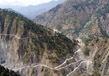
Mountains have a special geographical importance to the State of Jammu and Kashmir. The Kashmir valley is enclosed by high mountain chains on all the sides except for a few passes and a narrow gorge at Baramulla. There are the Siwalik hills to the south and very lofty mountains in the north; the peaks of which always remain covered with snow. Volcanic mountains that caused havoc in the past are also seen in the geography of the State.
Some of the famous mountains and their passes are:
1. Karakoram (8615.17 M) and Kyunlun Ranges
Both these mountains ranges lie towards the north and north-east of Jammu & Kashmir, separating it from Russian Turkistan and Tibet. In the north-west, Hindukush range spreads towards Karakoram Range that have the K2 peak considered being the second highest mountain peak in the world. High peaks of Gashorbram and Masharbram also lie here. People of Ladakh travel through Karakoram pass that is 5352 metres high and the Nubra pass while going to Turkistan and Khattan in China. Tibet can be reached from Ladakh through Kharudangala pass and Changla pass.
2. Zanskar Range
It lies at about 600 meters above sea level and separates Indus Valley from the valley of Kashmir; preventing the south-west cold winds from reaching Kashmir. The Ladakh region terminates at the Zojila pass (3529 metres) from where begins the valley of Kashmir. The ‘Poat pass’ (5716 metres) lying in this very range is also another famous mountain pass in this region.
3. Nun Kun Range
Lying between the Ladakh and Kashmir border, it is 7055.1 metres above mean sea level. To its south-east lies Kulu and towards the north-west, Kargil tehsil of Ladakh is situated. One has to pass through Bawalocha pass (4891 metres) in order to reach Leh (Ladakh) from Kulu. In 1947, when Kargil was attacked by Pakistan, Indian forces, arms and ammunition were sent to Ladakh through this pass.
4. Nanga Parbat Range
This range spreading in Gilgit with height of about 8107.68 metres above mean sea level is utterly devoid of vegetation. It was conquered by the Italian mountaineers in 1954. This region is now under the unlawful possession of Pakistan.
5. Harmukh Mountain
A range of the Himalayas situated at a height of 5141.3 metres above mean sea level lying towards Bandipore between the River Jhelum and Kishan Ganga valley.
6. Burzil Mountain
It bifurcates Kashmir and Ladakh on which theBurzil pass is situated at a height of 3200 metres.
7. Amarnath Mountain
Famous for its holy Amarnath Cave, situated at a height of 5372 metres above sea level it is visited by thousands of pilgrims every year on Rakshabandan. One has to pass the Mahagunas pass (1475 metres) on their way to Shri Amarnathji. Gwasharan (5450 metres) is situated in the Lidar valley towards Pahalgam; on which lies the famous Kolahi glacier. Sheeshnag Mountain also spreads in this valley. It is called Sheshnag as its peaks resemble the heads of seven big snakes.
8. Toshmaidan
Toshmaindan (4270 metres) and Kajinag (3700 metres) mountains lie in the Inner Himalayas. They remain snow-covered throughout the year, but during summers when the snow melts, it flows down into the Jhelum river.
9. Afarwat
This mountain spreads through the Gulmarg valley. The famous Alpatharspring lies on its peak, from which Nullah Nagal comes out and flows down into the WullarLake.
10. Pirpanjal Range
Separating Kashmir valley from the outer Himalayas, and this is about 2621 Kms in length and 50 Kms in the breadth. The famous Banihal pass (2832 metres) lies in the shape of a tunnel on its peak; covered with snow during winters making it impassable. At a height of 2200 metres above sea level a new tunnel 'Jawahar Tunnel' was constructed that is 2825 metres long; it was opened to traffic on 22nd Dec 1956.
On the other end of this range, Baramula pass (1582 metres) and Hajipir pass(2750 metres) are located. During 1965 Indo-Pak war, the Indian army had occupied this pass which was later handed over to Pakistan.
11. Siwalik Range
These hills extend from the north of the outer plains to middle mountains of the State reaching heights between 600 metres to 1500 metres.
12. Volcanic Mountains
Soyamji' (1860 metres) is one active peak in the North Machhipura (Handwara); that erupted for about 13 months in 1934. The other 'Kharewa' peak is a dormant one lying in Tehsil Pehalgam.
Related Image
Also Browse Following Under This Section
Related Topics
Culture in Jammu and Kashmir
The Indian state Jammu and Kashmir inhabits diverse and distinct culture. It encompasses various lifestyles and habits....
Cusines
The Indian state Jammu and Kashmir is not only considered as a paradise for its travelers but also for its food lovers....
Heaven On Earth
There is saying Heaven is nowhere, b...
Sonamarg Trekking
In Jammu and Kashmir, Trekking is the...